

Forget I-95. If you actually want to see the Carolina coast, you drive 17.
This isn’t a four-lane blur that passes billboards and gas stations. US Route 17 passes through woodlands, marshes, marine forests, and two-stoplight communities that still recall the days when this was the only route south. Depending on where you are, locals refer to it by different names, and each stretch has its own personality. Before you drive, think of this as your insider’s guide.
Affiliate Disclosure: This page contains affiliate links. If you book through them, we may earn a small commission at no extra cost to you.
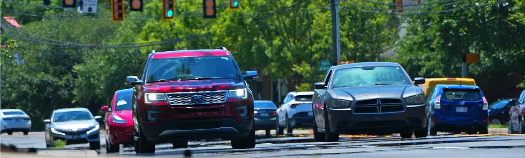
What Is US 17 Called in the Carolinas?
Honestly, it depends on who you ask.
The Coastal Highway is the designation given to the southeast portion of North Carolina, whereas the Ocean Highway is used for areas farther north. After crossing into South Carolina, the entire route, which stretches about 221 miles from Little River to the Georgia border near Savannah, regains the moniker “Coastal Highway.”
But this is the more profound past. This corridor was a section of the King’s Highway, a colonial-era post road that connected Charleston to Boston, long before it brought tourists to Myrtle Beach. During his 1791 Southern tour, George Washington himself visited several regions. Thus, you are essentially reliving a 250-year-old trip when you drive past Pawleys Island or Awendaw.
Locals’ take:
Ask someone in Georgetown for directions to “17,” and they’ll probably just call it “the coast road.” Nobody around here says “US Route 17” out loud.
Is US 17 Hard to Drive On?
Yes, some stretches. Others have the vibe of a Sunday cruise.
The road has a bad reputation. Because of its limited lanes, abrupt turns, and wildlife crossings through rural Lowcountry sections, outlets have ranked it as one of the nation’s most dangerous roadways. After years of severe collisions, South Carolina DOT extended a large portion of the formerly infamous two-lane run between Gardens Corner and Jacksonboro to four lanes.
Charleston traffic is a problem in and of itself. The Septima Clark Parkway and the Arthur Ravenel Jr. Bridge become a slow crawl on weekday mornings, and locals choose to avoid it rather than confront it. In the summer, Mount Pleasant also becomes crowded, particularly in the vicinity of the beach access points.
Most visitors are unaware that if you want to avoid the traffic in Myrtle Beach completely, you should take the Robert Edge Parkway to the Carolina Bays Parkway and then return to 17 South around Murrells Inlet. It avoids the worst of the Grand Strand congestion and removes real time from your drive.
Would you rather avoid the traffic along the coast? Designed to divert traffic off the main coastal route, US 17 Alternate travels inland from Pocotaligo to Georgetown.

Is US 17 a Scenic Highway?
Yes, especially when you go beyond the strip malls.
The road passes directly through the ACE Basin, one of the biggest undeveloped estuaries on the East Coast, south of Charleston. After that, it enters the Francis Marion National Forest, near McClellanville and Awendaw. Here, marsh grass reaches the horizon, making it hard to remember you are still on a numbered federal highway.
Further north, the drive between Pawleys Island and Georgetown offers postcard views of tidal creeks and old rice plantation land. The crossing at the Santee River feels like driving through a nature documentary. Even the Wilmington stretch has its moments, particularly when crossing the Cape Fear River on the Cape Fear Memorial Bridge, with the historic Battleship North Carolina visible below.
Insider Tip:
Near Myrtle Beach, most tourists miss an interesting historical detail. In 1931, John T. Woodside, a hunting preserve developer, actually paid to have the highway rerouted around his property. That land later became the Meher Spiritual Center, and traces of the older, quieter road can still be spotted if you know where to look.
Where to Stop Along the Way
A proper 17 road trip deserves a loose itinerary, not a race to the finish.
Start in Wilmington for riverfront dining and easy access to Carolina Beach, then work south through the Grand Strand. Stop in Pawleys Island for a slower pace before Myrtle Beach’s bigger crowds pull focus. Georgetown makes a perfect lunch stop, with a walkable historic waterfront that rewards a short detour off the highway.
Charleston obviously deserves more than a drive-through, so budget at least a night or two before continuing south. Beaufort rounds things out nicely, close enough to Hunting Island State Park for an afternoon beach detour before you cross toward Hilton Head or the Georgia line.
For lodging along the corridor, budget-minded travelers often lean on chains like Red Roof Inn, which keeps locations scattered along this route for exactly this kind of drive. And if you’re booking ahead, running your hotel search through Travelocity can help you compare rates across towns before committing to a stop.

The Bottom Line
US 17 isn’t the fastest route south, and that’s precisely its charm. Trade the interstate’s efficiency for panoramic marsh views, charming small-town lunch counters, and 250 years of coastal history unfolding alongside your journey. Slow down, and the Carolina coast will reveal exactly why it’s worth the extra hour.
FAQ
What is US Route 17 called in the Carolinas?
US 17 is known as the Coastal Highway throughout South Carolina and southeastern North Carolina. In northern North Carolina, it takes the name Ocean Highway. Locally, it’s often referred to simply as “17” or “the coast road.”
Is driving US 17 dangerous?
Some rural segments with narrow lanes and frequent wildlife crossings have contributed to a perception of poor safety; however, South Carolina has widened several of these more hazardous sections. In the Charleston area, traffic congestion, particularly near the Ravenel Bridge, is generally more of a daily inconvenience than a significant safety concern.
Is there a way to avoid Myrtle Beach traffic on US 17?
Yes, there are alternatives. Locals frequently use the Robert Edge Parkway and Carolina Bays Parkway to bypass Myrtle Beach, rejoining US 17 south of Murrells Inlet. Additionally, US 17 Alternate provides an inland bypass between Pocotaligo and Georgetown.
How long does it take to drive the entire Carolina stretch of US 17?
The North Carolina portion of US 17 spans approximately 286 miles, with an additional 221 miles in South Carolina. Driving the full coastal corridor typically requires a full day or more, depending on traffic and the number of stops.
Is US 17 the same as the historic King’s Highway?
Portions of US 17 follow the path of the historic King’s Highway. Long segments of the current route align with the original colonial-era road that once linked Charleston to Boston. George Washington himself traveled sections of this highway in the 1790s.
A note on accuracy: Traffic patterns, construction zones, and speed limits along US 17 vary by season and location. Always check current conditions before embarking on a long drive.
For more Carolina vacation area guides and Carolina coastal travel inspiration, dive deeper into explorecarolinabeaches.com and our Festival Guides.
Planning a Carolina beach trip? Use our Beach Finder Quiz to get a personalized recommendation, or compare any two beaches side by side with the Carolina Beach Comparison Tool.
📱 Download our free Carolina Beaches app — Get it here